
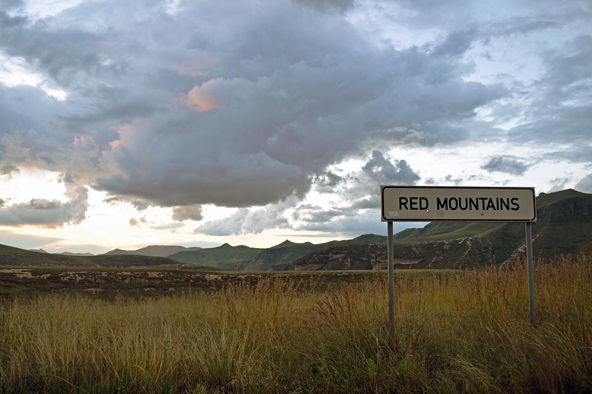
Most visitors stop at Golden Gate Highlands National Park to admire its glowing sandstone cliffs and sweeping mountain scenery. Few realise they are also looking at the remains of ancient deserts, the aftermath of powerful volcanic eruptions, and landscapes that have been evolving for nearly 200 million years.
Along the park’s main road, a handful of viewpoints reveal the remarkable geological story hidden within the scenery. Each stop offers another clue to how this iconic landscape came to be. These Golden Gate Highlands National Park viewpoints invite you to slow down and discover the extraordinary forces that shaped the mountains long before people ever travelled through them.
It’s easy to drive straight past these roadside stops, but they are among the most rewarding few minutes you can spend in the park, yet another activity while visiting this gem in the Free State Province of South Africa.
Golden Gate Highlands National Park viewpoints worth stopping for
Protea Corner – where an unexpected mountain forest survives
Golden Gate Highlands National Park lies within South Africa’s grassland biome, yet the cliffs shelter a surprising secret.
Hidden within cool, shaded pockets of the mountains are isolated patches of afromontane shrubland, a vegetation type more commonly associated with higher, wetter mountain environments. Protected from the harshest conditions, these rocky refuges provide just enough moisture for species that would otherwise struggle to survive here.
Among them are Protea caffra and Protea roupelliae, although their pastel-coloured flowers are not always visible depending on the season. Regular winter fires also influence how these plants regenerate and shape the surrounding vegetation. Other tree species found in these sheltered areas include real yellowwood (Podocarpus latifolius) and mountain hard pear (Olinia emarginata).
Protea Corner offers one of the easiest places to spot these unexpected islands of mountain vegetation. If they are not immediately obvious, a pair of binoculars can help reveal the darker patches clinging to the cliffsides.
You’ll find the viewpoint about 15km from the eastern entrance on the left-hand side of the road.
Dolerite Dyke – where magma cut through the mountains
Golden Gate’s dramatic landscape was shaped not only by wind and water, but also by powerful volcanic forces deep beneath the Earth’s surface.
When immense pressure built underground, molten magma forced its way through cracks in the surrounding rock. As it cooled and hardened, it formed geological structures known as dykes and sills.
Dykes form when magma cuts vertically through existing rock layers. Sills form when magma spreads horizontally between those layers.
From this viewpoint, look across the valley, and you may notice a dark band interrupting the golden sandstone cliffs. It slopes gently southwards, standing out from the surrounding rock. You are looking at part of a dolerite dyke that stretches for roughly 30 kilometres through the park – the scar left behind by molten rock that solidified millions of years ago.
If the dyke itself is difficult to spot, look at the vegetation instead. Dolerite breaks down into nutrient-rich soils that often support diverse plant communities, making the intrusion’s line much easier to identify. A sign on the right-hand side of the road marks this viewpoint.
Sandstone Valley – when deserts became cliffs
Standing at Sandstone Valley, it took a moment to realise that every cliff in front of me had once been a sea of shifting sand. It’s one thing to read that these rocks are ancient dunes; it’s quite another to look across the valley and imagine a desert where mountains now stand.
Around 196 million years ago, powerful westerly winds swept vast quantities of sand across this region, gradually building enormous dunes similar to those found in modern deserts. Over millions of years, those loose sand grains were compressed and cemented together, eventually forming the Clarens Sandstone.
Wind, rain and erosion then spent millions more years sculpting the rock into the spectacular cliffs, caves and buttresses that dominate the landscape today.
From this viewpoint on the right-hand side of the road, almost everything you see across the valley was once part of that ancient desert. Every cliff, ridge and rock formation began as loose grains of wind-blown sand before time slowly transformed them into stone.
Red Mountains – reading 200 million years of history
The final viewpoint along the main road offers more than a spectacular panorama. It provides a cross-section through millions of years of Earth’s history.
The mountain before you is like an open history book, with each coloured layer recording a different chapter in the region’s geological past.
At its base lies mudstone that formed around 200 million years ago, when this landscape was a wetland or floodplain. Fine layers of mud and silt settled in shallow water before gradually drying, compacting and hardening into rock as environmental conditions changed.
Because mudstone is relatively soft and porous, it erodes far more easily than the harder rock layers above it.
Resting atop it is the golden Clarens Sandstone, formed from ancient desert dunes, while the dark cap above it is Drakensberg Basalt, created during vast volcanic eruptions that once blanketed much of southern Africa with lava.
The rich red tones visible in parts of the mountain developed when iron-rich minerals oxidised under hot, arid conditions, leaving behind the colours that make this viewpoint so striking today.
As the road climbs uphill, you’ll find the sign marking this viewpoint on the left-hand side.
A landscape shaped over millions of years
Golden Gate Highlands National Park is often celebrated for its dramatic scenery, but understanding how that scenery formed makes it even more remarkable.
Ancient deserts, changing climates, volcanic eruptions and relentless erosion have all left their mark on these mountains. What appears at first to be a beautiful landscape is, in reality, a geological record stretching back nearly 200 million years.
The next time you drive through the park, don’t simply admire the views. Pause at each viewpoint, look beyond the scenery and imagine deserts stretching to the horizon, lava flowing across the landscape and countless millennia of wind and rain slowly carving the cliffs before you.
Once you know the story written in the rocks, it’s impossible to see these Golden Gate viewpoints in quite the same way again.
Tips for visiting Golden Gate’s viewpoints
- Allow about an hour to fully appreciate all four Golden Gate viewpoints.
- Most viewpoints have space to pull over safely, but watch for passing traffic.
- Early morning and late afternoon offer the best light for photography, when the sandstone cliffs glow with their famous golden colours.
Love stories like this one?
See more of our content under our latest posts. You can also join others like you by subscribing to our newsletter.
Have you ever stood by any of these Golden Gate Highlands National Park viewpoints? Share your favourite in the comments. Remember to share this story on social media.
Copyright 2026 Never-ending Nature. All rights reserved. This material may not be published elsewhere or rewritten without permission.


